Best ATV GPS Systems
Never get lost again on your ATV with one of these ATV GPS systems
The Best ATV GPS system is perfect for those of us who like to explore the (off)road less traveled. We’ve done the research and compiled the best available GPS for trail riding options together in one article.
I can proudly say that I’ve never been lost. I just have found places that I haven’t been to before and from where I may not quite know how to get back to where I started from, but that doesn’t mean I’m lost. That’s what I always tell my wife when she asks if we’re lost. She doesn’t always believe me, but like Inigo Montoya said in The Princess Bride, I know something that she does not know. No, I’m not left-handed, but I do have a backup plan. I always have a GPS with me to help me find my way. Today’s GPS systems available to off-road enthusiasts have more features and are much more user friendly than ever before. Here are the best ATV and UTV GPS systems that will help you find your way home, avoid any arguments and are less expensive than you might think. You can thank me later.
Cover Image by Author
Table of contents
- 1. Editor's Choice: Magellan TRX-7 CS Pro
- 2. Compact Powerhouse: Garmin Zumo XT
- 3. Mid-Range Winner: Magellan TR7
- 4. GPS Alternative: onX Offroad App
- 5. Perfect Plotter: Lowrance HOOK2-5 Baja Overland Offroad Chart Plotter GPS
- 6. Handheld and ATV Unit: Garmin GPSMAP 64st
- 7. Yamaha Adventure Pro
- How To Use an Off-Road GPS
- Using an Off-Road GPS For Planning a Route
- Using an Off-Road GPS On the Trail
- Sharing Your Experiences
- What should I consider when purchasing an ATV GPS?
- Can I use Google Maps as my GPS?
- How does an off-road GPS work?
- Do You Need an Off-Road GPS for your ATV?
1. Editor's Choice: Magellan TRX-7 CS Pro
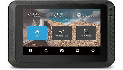
Magellan’s top of the line off-road GPS system, the TRX7 CS Pro comes out of the box with over 160,000 preloaded trails, high resolution topographic and 3D base maps, track a built-in 8MP camera to record your adventures and take photos on the trail. The water, dust and shock proof unit also has traditional turn by turn trail and street capability that you’ll find in most portable GPS systems, but this unit is also WiFi capable to share your favorite trail videos trail information when connected to your hotspot, phone or WiFi system at home. For a unit loaded with so many features, it’s easy to see why we picked this as our favorite ATV GPS system.
Pros
- large screen and updatable
Cons
- Size works best with UTVs
Bottom Line
- A dependable, accurate GPS system
Magellan’s top of the line off-road GPS system, the TRX7 CS Pro comes out of the box with over 160,000 preloaded trails, high resolution topographic and 3D base maps, track a built-in 8MP camera to record your adventures and take photos on the trail. The water, dust and shock proof unit also has traditional turn by turn trail and street capability that you’ll find in most portable GPS systems, but this unit is also WiFi capable to share your favorite trail videos trail information when connected to your hotspot, phone or WiFi system at home. For a unit loaded with so many features, it’s easy to see why we picked this as our favorite ATV GPS system.
2. Compact Powerhouse: Garmin Zumo XT
One of the newer ATV GPS systems on the market, the Garmin z?mo XT all-terrain navigator is built to help you find your way along the trail. It has an ultra-bright 5.5” display that is glove-friendly and water-resistant. The z?mo XT is capable of withstanding all kinds of weather, extreme temperatures and vibrations, but just don't drop it in the lake and expect it to work perfectly. The GPS is loaded with routes in North America, with turn-by-turn directions when used on-road for navigation, and it uses topographic or birds' eye satellite imagery for off-road guidance.
The z?mo gives you rider alerts to what's ahead on the trail. Easily manage and review routes, tracks and waypoints across your navigator, smartphone and computer using the Garmin Explore app, without the need for any kind of subscription. You can pair with a compatible inReach satellite communicator (sold separately) for interactive SOS, two-way messaging and location sharing. A battery life of 3.5 hours gives decent time for excursions away from your vehicle, where you'd likely just leave it connected to power through your cigarette lighter. Leave it to Garmin to come out with a sweet new way to stay on the trail.
Pros
- Glove touch screen, loads of features to keep you on the trail
Cons
- Smaller size might be harder to use with UTVs
Bottom Line
- A sweet, compact GPS system
One of the newer ATV GPS systems on the market, the Garmin z?mo XT all-terrain navigator is built to help you find your way along the trail. It has an ultra-bright 5.5” display that is glove-friendly and water-resistant. The z?mo XT is capable of withstanding all kinds of weather, extreme temperatures and vibrations, but just don't drop it in the lake and expect it to work perfectly. The GPS is loaded with routes in North America, with turn-by-turn directions when used on-road for navigation, and it uses topographic or birds' eye satellite imagery for off-road guidance.
The z?mo gives you rider alerts to what's ahead on the trail. Easily manage and review routes, tracks and waypoints across your navigator, smartphone and computer using the Garmin Explore app, without the need for any kind of subscription. You can pair with a compatible inReach satellite communicator (sold separately) for interactive SOS, two-way messaging and location sharing. A battery life of 3.5 hours gives decent time for excursions away from your vehicle, where you'd likely just leave it connected to power through your cigarette lighter. Leave it to Garmin to come out with a sweet new way to stay on the trail.
3. Mid-Range Winner: Magellan TR7
Magellan has gone and made some of the best ATV GPS systems for the off-road community, and for 2019 , they have not only improved on the lineup, but made them more affordable. The TR7 retails for under $400 and is loaded with 115,000 trails! Yes, you read that right trails – not roads. They have those on there too, but 115,000 trails is HUGE. It has a 7-inch touchscreen display that is shock, dust and water resistant. You can expand on the trails available by using the TRX Trailhead website where users map out and upload even more maps. No matter what vehicle you ride, this is one of the best off road GPS devices available.
Pros
- Fits well with any ATV or UTV
Cons
- Mounting can be a little tricky
Bottom Line
- A great GPS unit!
Magellan has gone and made some of the best ATV GPS systems for the off-road community, and for 2019 , they have not only improved on the lineup, but made them more affordable. The TR7 retails for under $400 and is loaded with 115,000 trails! Yes, you read that right trails – not roads. They have those on there too, but 115,000 trails is HUGE. It has a 7-inch touchscreen display that is shock, dust and water resistant. You can expand on the trails available by using the TRX Trailhead website where users map out and upload even more maps. No matter what vehicle you ride, this is one of the best off road GPS devices available.
4. GPS Alternative: onX Offroad App
Most all of us have smartphones, tablets or laptops these days. And I'm sure you've at least seen an ad for the onX app, especially if you're a hunter. onX started as a hunting app to help people map and navigate their hunting property, but it has evolved way past that. The onX Offroad App is loaded with over 400,000 miles of off-road trails in all 50 states, and with the most accurate and intelligent off-road GPS mapping tool you can get. View private and public land, including national forest, BLM, national parks and OHV riding areas. Trails are color-coded to quickly see which are open: green = open and red = temporarily closed. Tap a trail for information including trail details, closure dates, difficulty ratings, photos and more. onX Offroad covers more than 985 million acres of public land with thousands of recreation points such as campgrounds, non-ethanol fuel stations and trailheads. You can use the app to plan out the perfect ride and then go do it. Sounds great! When do we leave?
Pros
- Highly accurate trail mapping app and service
Cons
- You need a signal to update as you go
Bottom Line
- The future is now
Most all of us have smartphones, tablets or laptops these days. And I'm sure you've at least seen an ad for the onX app, especially if you're a hunter. onX started as a hunting app to help people map and navigate their hunting property, but it has evolved way past that. The onX Offroad App is loaded with over 400,000 miles of off-road trails in all 50 states, and with the most accurate and intelligent off-road GPS mapping tool you can get. View private and public land, including national forest, BLM, national parks and OHV riding areas. Trails are color-coded to quickly see which are open: green = open and red = temporarily closed. Tap a trail for information including trail details, closure dates, difficulty ratings, photos and more. onX Offroad covers more than 985 million acres of public land with thousands of recreation points such as campgrounds, non-ethanol fuel stations and trailheads. You can use the app to plan out the perfect ride and then go do it. Sounds great! When do we leave?
5. Perfect Plotter: Lowrance HOOK2-5 Baja Overland Offroad Chart Plotter GPS
I know what you’re thinking – that’s a fishfinder! It isn't anymore. Lowrance makes some of the best GPS chart plotting system technology in the world and they have been slowly building into the off-road world. This unit is their popular HOOK2 system, but they have stripped out the sonar technology that you wouldn't need or want in a UTV GPS system. With this GPS plotter, you'll need to load off a map service, like a regional map. It also works best with an external GPS antenna. Where this plotter has found a home is with competition UTVs and trucks. Properly set up, this plotter can keep you on track regardless of the conditions, making it a winner to us.
Pros
- Perfect for UTV racing
Cons
- Needs add-ons to work best
Bottom Line
- If you're racing, this is a unit you will love!
I know what you’re thinking – that’s a fishfinder! It isn't anymore. Lowrance makes some of the best GPS chart plotting system technology in the world and they have been slowly building into the off-road world. This unit is their popular HOOK2 system, but they have stripped out the sonar technology that you wouldn't need or want in a UTV GPS system. With this GPS plotter, you'll need to load off a map service, like a regional map. It also works best with an external GPS antenna. Where this plotter has found a home is with competition UTVs and trucks. Properly set up, this plotter can keep you on track regardless of the conditions, making it a winner to us.
6. Handheld and ATV Unit: Garmin GPSMAP 64st
When we started this list, the GPS units listed above were the easy picks for the Five Best available. There are several others that could make this list, they just are a tad more specialized in application. The Garmin GPSMAP 64st is a seriously cool ATV trail GPS. Why didn't it make the top five? Well, it's a hand-held device, so the screen is small at 2.6 inches, making it harder to use while riding. However, this is one packed little handheld with full topographic mapping, and it has wireless capability meaning that you can share the screen and information to your cellphone, tablet or more, and you can share the info with others, too. Being a Garmin, it is fully waterproof, shock resistant and has a quad-helix antenna for serious accuracy. It has bird's eye view topographic mapping, too. The lesser models are great for hikers or cyclist looking for a decent GPS system with ANT capability for various sensor inputs, but when you want to see the finer details, the 64st can't be beat.
Pros
- Tough unti best suited for ATVs or along the trail
Cons
- Smaller size
Bottom Line
- A great hand held with cool off-road features.
When we started this list, the GPS units listed above were the easy picks for the Five Best available. There are several others that could make this list, they just are a tad more specialized in application. The Garmin GPSMAP 64st is a seriously cool ATV trail GPS. Why didn't it make the top five? Well, it's a hand-held device, so the screen is small at 2.6 inches, making it harder to use while riding. However, this is one packed little handheld with full topographic mapping, and it has wireless capability meaning that you can share the screen and information to your cellphone, tablet or more, and you can share the info with others, too. Being a Garmin, it is fully waterproof, shock resistant and has a quad-helix antenna for serious accuracy. It has bird's eye view topographic mapping, too. The lesser models are great for hikers or cyclist looking for a decent GPS system with ANT capability for various sensor inputs, but when you want to see the finer details, the 64st can't be beat.
7. Yamaha Adventure Pro
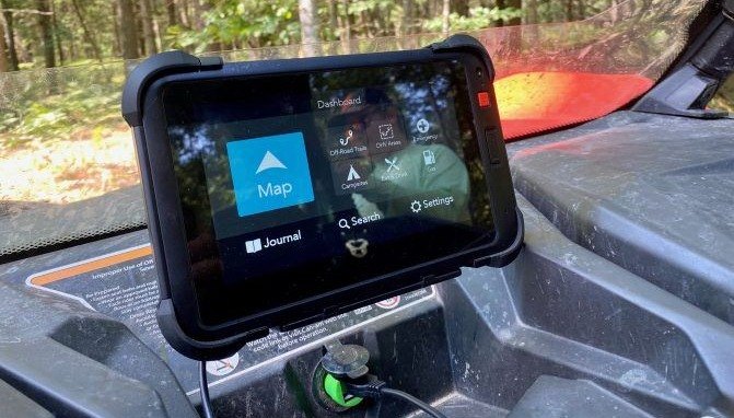
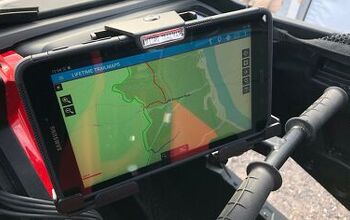
Yamaha released its Adventure Pro tablet GPS system developed in conjunction with Magellan and it is outstanding to say the least. This tablet-style GPS is water and shock proof and has full GPS mapping capabilities. It also has access to a wide-range of trail system maps and other topographical maps to help you navigate through wherever you should end up. Some Yamaha Grizzly models are pre-wired for the tablet with a special dock to let it ride right under the bars. Expect more Yamaha machines to offer options involving the Adventure Pro system, too.
How To Use an Off-Road GPS
(by Casey Cordeiro)
In the off-road world, new GPS systems are sprouting up all the time and most of the GPS systems on the market have pre-loaded off-road trails that help you determine where trails lead and where you should go next. This is a huge help when you’re navigating in real-time off-road. Plus, many systems go even further by offering the navigator the opportunity to plot their own routes for your next trip. In addition to stand alone portable GPS units (think Yamaha Adventure Pro and Garmin Overlander), there are multiple GPS apps that allow you to utilize your smartphone or tablet for navigation, should you already have one of these devices.
Let's dig into specifics on how to use an ATV GPS system.
Using an Off-Road GPS For Planning a Route
Besides the obvious – using a GPS for navigation when you’re on the trail – you can also use a modern GPS device (or system) for planning a route before you actually leave your house. By using this functionality, you are also able to understand the terrain you are going to tackle before you actually get out there. Allow me to explain a bit…
If you use a Magellan or Garmin device, it will have access to tens of thousands of preloaded trails, which helps you make routes with open, accessible trails. Seeing that people have completed these trails (these are all user-uploaded) also gives you the confidence to explore more when you’re planning routes. Again, once you finish your route and mark it out on your computer, make sure your device is connected to a Wi-Fi network so it can sync with your online account. Once synced, your route that you made will be on your device and ready to follow.
Using an Off-Road GPS On the Trail
No matter which system you have, using an off-road GPS on the trail allows you to perform several important navigational functions, including: tracking your route as you move down the trail (so you can easily return down the same path, along with saving it for next time), placing markers at locations or obstacles that you want to remember at specific points along the trail (also known as Waypoints), and follow route guidance of a predetermined route that you put together before your ride.
If you’re a person who isn’t completely confident with your navigational abilities (it’s OK!), you should first get a GPS to have with you on any off-road adventure. Second, you need to mark your camp site each time you get to a riding area on your GPS. It sounds tedious, but you’ll appreciate that you did this… Third, before you leave camp for each ride, use your off-road GPS for what it was made to do – record your track as you go down the trail. If you do this, you will have no issues getting back to camp. It seems simple, and it is!
The other reason to record a track every time you leave camp is in case of emergencies. We don’t like to think of “emergencies” as a reason to track your route, but you’ll be so happy you did if you do have an issue on the trail and need to get back to camp quickly from your location.
The other thing that all off-road GPS systems allow you to do is pinpoint your coordinates while out on the trail. Again, we don’t like to think that there will be emergencies out there, but things happen, whether it is someone in your group or someone in another group of riders. You could save a life and not even have that intention before you leave camp!
Sharing Your Experiences
One of the best innovations in GPS device technology is that you can instantly share your routes with friends and family. After putting routes and tracks on their own GPS systems, your buddies will be able to share the experience that you just had on the trail. It’s great for everyone!
The exporting process for sharing tracks/routes is a bit different for each system, but as long as you look up the way to export the files, you’ll be able to share them with whoever you like so they can go and try the same route out for themselves.
What should I consider when purchasing an ATV GPS?
First and foremost, you'll want a GPS that isn't overly complicated. It can be tempting to purchase a GPS system that is used by the fastest racers in the world, but chances are it may feature many bells and whistles and you'll never need and may be more difficult than less expensive units that will fulfill your needs perfectly. A good GPS system will also feature pre-loaded maps that have your favorite trails in them and the topographical information. Many of the manufactures will offer free map updating, which is great because it'll give you even more options to explore. Depending on what kind of machine you're putting it on, the size of the screen is important so you can easily see your routes and tracks.
Can I use Google Maps as my GPS?
Yes and no. If your off-road adventures are places where you 've got perfect cell service then Google Maps might be ok for you, but in all reality what are the chances of that? While Google Maps uses satellite technology to pinpoint your location, it still relies on cellular service to update the maps that show where you are. That is why it's critical that the GPS system you purchase either features preloaded maps or the ability to upload maps.
How does an off-road GPS work?
As mentioned above, GPS units use satellite technology to pinpoint your location. The strength of the signal for your GPS unit depends on how many satellites are used to track your location. This is why when you first turn on your GPS unit, it takes a few minutes to determine your location. If you're using a GPS with saved or pre-loaded maps that already feature trails and topography of the area, you location is usually accurate within a few feet and you'll see the map immediately. As mentioned previously, Google Maps relies on cellular service to load maps, so your location can be pinpointed by a satellite but you won't be able to see landmarks till a map loads.
Do You Need an Off-Road GPS for your ATV?
Well, do you like getting lost? I’m kidding, of course. But they do help you stay on the trail and even help you find your way to new trails. Systems like Magellan’s and companies like Yamaha and Polaris are making it easier to find new trails through GPS by having online data you can download. These websites provide you with complete trail maps right on your GPS, and have waypoints and trail info from other users inputted right into the data stream. Very cool stuff. The best ATV GPS systems also work well when you’re trying to ride as a group, by keeping everyone on the same trail.
Additional Resources
Recent Updates:
06/14/2023: Updated product links and removed obsolete products
02/24/2022: Updated product descriptions, removed out of stock product, added new product (Magellan TRX7 CS Pro), added FAQ and added additional resources
Sept 16, 2021: Added FAQ, added additional resources, updated product links, updated product descriptions
March 19, 2021: Added additional information on off-road GPS systems.
Become an ATV insider. Get the latest news first by subscribing to our newsletter here.
We are committed to finding, researching, and recommending the best products. We earn commissions from purchases you make using the retail links in our product reviews. Learn more about how this works.
Derrek's love for all things ATV started when he was a mere 11 years old, growing up on his family farm. His mom gave him and his sister a choice - get a horse, or a three-wheeler. The sister wanted the horse, and Derrek wanted the ATV. Luckily he won out, and was soon burning up the trails on a Yamaha Tri-Moto 200. By the time he was 14, he had saved enough of his own money by working on the farm and in his folks restaurant to buy a new 4-wheeler. That happened the day he and his mom were driving past the dealership and saw 1987 Banshee. His mom had no idea what he was buying, and he never looked back. He's been riding ever since, and been writing professionally for many years. He has ridden all over North America and been behind the controls of just about every machine out there. And yes, he still has his 1987 Yamaha Banshee.
More by Derrek Sigler






![Derek Guetter Lands 75-foot Back Flip [video]](https://cdn-fastly.atv.com/media/2022/10/24/8742829/derek-guetter-lands-75-foot-back-flip-video.jpg?size=350x220)
![MIT Student Develops Off-Road Wheelchair [video]](https://cdn-fastly.atv.com/media/2022/10/24/8744100/mit-student-develops-off-road-wheelchair-video.jpg?size=350x220)
